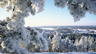
Paloisvuori
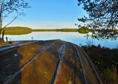
Paloisvuori is a sports and recreation area (at Uotilanniementie 33) offering a wide range of opportunities for sports on the narrow ridges called eskers that rise to the south of Iisalmi's town centre. When you climb Paloisvuori Hill, you'll be rewarded by the magnificent views across Lake Paloisjärvi towards the town centre. The area has an extensive network of walking routes along with cross-country ski tracks and a downhill ski centre during the winter. ''Paloski'' has a ski lope, a slegding slope and a ski lift, plus a small cafe. In summer, you can play on the disc golf course (18 baskets) or explore the waymarked mountain bike trails. The walking routes distances are 2.3 to 4.2 km. The terrain is varied and hilly. Come along to enjoy exercise at Paloisvuori! For more information about Paloisvuori's walking routes and other sports, visit Iisalmi city council's website at
www.iisalmi.fi/paloisvuori
For the hiking destination maps, go to
www.iisalmi.fi/retkeily
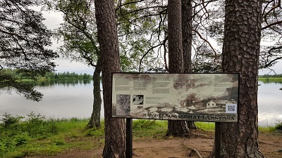
Koljonvirta
On the Koljonvirta history trail with its information stops and monuments you can discover how life was in the heart of Savo, and find out about the history of the Finnish War of 1808-1809. The trail is 2 km long. A campfire site is located along the trail. Start at Mansikkaniemi in Koljonvirta by Juhani Aho Museum.
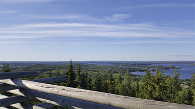
Väisälänmäki
Explore this impressive national landscape in Lapinlahti. The area is signposted from national route 5, and is located 12 km from the town centre of Lapinlahti. Väisälänmäki has a 3 km cultural nature trail across an ancient slash-and-burn landscape and a lookout tower. In summer, you can break your walk at Karjamaja cafe along the route and visit the small museum. There are also several rest stops and a shelter along the way.
For more information and group bookings, contact
Lapinlahti 4H Club
Tel. +358 40 519 7305 or +358 40 519 7211
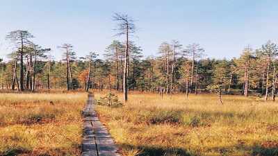
Talaskangas
Talaskangas Nature Reserve contains forests and mires that have remained very close to their pristine, natural state. Talaskangas is considered as the southernmost wilderness area in Kainuu. As all other nature reserves in this area are mires, Talaskangas has become very important for the preservation of woodland habitats. Talaskangas serves nature and environmental research along with educational purposes. There is a parking site by Jyleikönkangas and Talaskangas at the start of the hiking trail. Both car parks have information boards. Talaskangas has 12 km of easy hiking trails. In the north of the reserve, the trail branches by Heinosenaho logging site that has become famous for the direction action taken by environmental activists. There are three campfire sites along the route: lean-to shelters by Lake Patalampi and on the headland by the western shore of Pikku-Talas, and a campfire shelter north of Pikku-Talas. The distance from Vieremä town centre to the start of the hiking trails is 33 km. For directions and route maps contact the information desk at Vieremä's municipal office.
www.luontoon.fi/talaskangas
www.excursionmap.fi
Älänne
Lake Älänne-järvi, characterised by its wide open waters, and the Tiilikanjoki River with its rapids form an area of stunning natural beauty together with the valuable and distinctive esker landscape. The landscape is further enriched by large open mires. Älänne has 19 km of trails such as the circular routes of Huuhkajan kierros (6 km) and Kaivannonkierto (3 km). A leanto shelter and campfire sites are located along the trails. This extensive network of lakes is a great place for canoeing and rowing. Start the Älänne trails from the car parks by Vongankoski, Näätähiekka and Rouskunhiekka.
www.luontoon.fi/alanne
www.excursionmap.fi