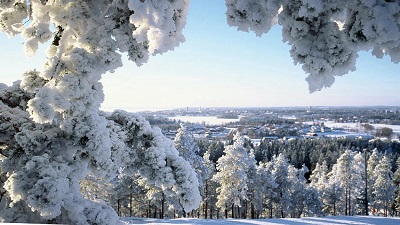
Nature is everywhere, feel free and explore it in every way, in every season

Did You know that in Finland everyman is basically entitled to walk, pick up berries and mushrooms freely in natural areas, as long as this causes no harm to property or nature? This right does not cover private yards. Everyman’s right comes with restrictions also in nature conservation areas, such as national parks, nature reserves and protected areas for birds. Ask for guided nature tours!

Get mobile maps for hiking, fishing and hunting www.excursionmap.fi/mobile

More information about fishing www.kalapaikka.net

Hiking Routes

paloisvuori.jpg

Paloisvuori

Paloisvuori is a sports and recreation area (at Uotilanniementie 33) offering a wide range of opportunities for sports on the narrow ridges called eskers that rise to the south of Iisalmi's town centre. When you climb Paloisvuori Hill, you'll be rewarded by the magnificent views across Lake Paloisjärvi towards the town centre. The area has an extensive network of walking routes along with cross-country ski tracks and a downhill ski centre during the winter. ''Paloski'' has a ski lope, a slegding slope and a ski lift, plus a small cafe. In summer, you can play on the disc golf course (18 baskets) or explore the waymarked mountain bike trails. The walking routes distances are 2.3 to 4.2 km. The terrain is varied and hilly. Come along to enjoy exercise at Paloisvuori! For more information about Paloisvuori's walking routes and other sports, visit Iisalmi city council's website at
www.iisalmi.fi/paloisvuori

For the hiking destination maps, go to
www.iisalmi.fi/retkeily
Koljonvirta-Mansikkaniemi5banneri.jpg 

Koljonvirta

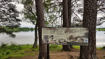
On the Koljonvirta history trail with its information stops and monuments you can discover how life was in the heart of Savo, and find out about the history of the Finnish War of 1808-1809. The trail is 2 km long. A campfire site is located along the trail. Start at Mansikkaniemi in Koljonvirta by Juhani Aho Museum.
 Väisälänmäki.jpg 

Väisälänmäki

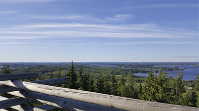
Explore this impressive national landscape in Lapinlahti. The area is signposted from national route 5, and is located 12 km from the town centre of Lapinlahti. Väisälänmäki has a 3 km cultural nature trail across an ancient slash-and-burn landscape and a lookout tower. In summer, you can break your walk at Karjamaja cafe along the route and visit the small museum. There are also several rest stops and a shelter along the way.

For more information and group bookings, contact
Lapinlahti 4H Club
Tel. +358 40 519 7305 or +358 40 519 7211
talaskangas.jpg 

Talaskangas

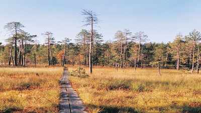
Talaskangas Nature Reserve contains forests and mires that have remained very close to their pristine, natural state. Talaskangas is considered as the southernmost wilderness area in Kainuu. As all other nature reserves in this area are mires, Talaskangas has become very important for the preservation of woodland habitats. Talaskangas serves nature and environmental research along with educational purposes. There is a parking site by Jyleikönkangas and Talaskangas at the start of the hiking trail. Both car parks have information boards. Talaskangas has 12 km of easy hiking trails. In the north of the reserve, the trail branches by Heinosenaho logging site that has become famous for the direction action taken by environmental activists. There are three campfire sites along the route: lean-to shelters by Lake Patalampi and on the headland by the western shore of Pikku-Talas, and a campfire shelter north of Pikku-Talas. The distance from Vieremä town centre to the start of the hiking trails is 33 km. For directions and route maps contact the information desk at Vieremä's municipal office.

www.luontoon.fi/talaskangas
www.excursionmap.fi
Älänne.jpg

Älänne

Lake Älänne-järvi, characterised by its wide open waters, and the Tiilikanjoki River with its rapids form an area of stunning natural beauty together with the valuable and distinctive esker landscape. The landscape is further enriched by large open mires. Älänne has 19 km of trails such as the circular routes of Huuhkajan kierros (6 km) and Kaivannonkierto (3 km). A leanto shelter and campfire sites are located along the trails. This extensive network of lakes is a great place for canoeing and rowing. Start the Älänne trails from the car parks by Vongankoski, Näätähiekka and Rouskunhiekka.

www.luontoon.fi/alanne
www.excursionmap.fi

soidinsuo.jpg

Soidinvuori

A 7 km hiking route with varied, beautiful terrain. There are several campfire sites and rest stops along the way. The route starts from the Paloisenlammintie road. Driving directions: from national road 5, take road 87 towards Sonkajärvi. Continue for just over 9 km and turn to Paloisenlammintie. Continue for approximately 2.5 km. You can access the trail from the right side of the road.

 volokinpolku.jpg

Volokinpolku

Volokinpolku is a marked, 30 km wilderness hiking route across the hills of Eastern Sonkajärvi. It starts from Jyrkän Ruukki historic ironworks, then winds its way through the sand ridges around Kangaslampi to Eräholi and Lake Haajaistenjärvi, dips down to Uuranholi canyon and ends by Susi-Kervinen at the border of Rautavaara municipality. You can also walk the route starting from Susi-Kervinen. Explore the whole route or split it into sections depending on the time available and your fitness level. Ask Ruukin Tupa dor hiking and canoeing guides, meals and transport for the route. If you need something extra to the adventure, include a canoeing section to your route: Paddle from Jyrkkä across Lake Kiltuanjärvi to Haajainen and stay overnight in a fishing lodge on the private island Savisaari. Next morning, enjoy a warm-up paddle to the mainland and then continue your hike from Kiusalankangas to Uuranholi, taking and lean-to shelters along the way including an open wilderness hut for overnight stays by Lake Jussinlampi. Wooden duckboards have been laid to allow easier access across boggy areas. The route has 6.5km of duckboards.

Jyrkän Ruukki/Ruukin Tupa
Tel. +358 45 859 7889, +358 50 353 1897
ruukinkahvila@gmail.com
www.ruukintupa.fi


Kotaharju lookout tower and hiking trails

Kotaharju hiking area includes a 20 metre lookout tower on Kotaharju Hill, a lodge and a network of trails. During summer weekends, Kiipeli kiosk is open at the bottom of the tower.

Kotaharjuntie 111, 74300 Sonkajärvi
Tel. +358 40 849 3100


Aarnikotka Trail

Aarnikotka Trail is a hiking route with diverse and varied attractions. The route uses old trails, cart roads and village lanes. It passes several points of interest such as the Siltalanlohi recreational fishing site, Kuorejärvi's slash-and-burn farm, the old spruce stands by Kotvakkojoki and Talaskangas Nature Reserve. Plant life found along Aarnikotka Trail is particularly diverse along the Kotvakkojoki River and the slashand-burn fields by Lake Kuorejärvi. It varies from herb-rich wooded mires to man-made meadows growing grass and hay. The 30 km waymarked trail starts from the sports centre in Vieremä town centre and ends in Talaskangas. There are three lean-to shelters with campfire sites along the route at Hukkala, Pitkäkangas and Läsykoski.
www.excursionmap.fi

 42228486292_fe6aeaea4d_k11.jpg 

Hällämönharju

Located 32 km to the north-east of Vieremä, Hällämönharju has been designated a national site for the protection of eskers. The Hällämönharju esker is a long ridge with steep sides nestling in a beautiful natural setting. It belongs to one of Finland's longest series of eskers running from the south-east to north-westerly direction. The esker is characterised by large trees along with kettle holes and small waters representative of the habitat. The highest parts of Hällämönharju have never been under water in the postglacial period (i.e. they were sea shores). The water level has remained at the 170 m contour line as shown by the shore rocks still in view. The glacial period ended about 9,600 years ago in the Vieremä region. The top Hällämönharju os accessible by car or by foot on the hiking trails. The Linnaharju shelter and nature trail with its information boards are located very close to Hällämönharju.

www.excursionmap.fi 

Hiking Destinations Nearby

Tahko

There are many ways to conquer Tahkovuori Hill. Running up the longest steps in Finland is a good start. Tahko resort has several trails and extensive facilities for summer and winter activities alike. https://www.kuopiotahko.fi/en/


20180630_152019.jpg

Tiilikkajärvi National Park

Tranquil shores await in the heart of this National Park. The finest of these sandy beaches is Venäjänhiekka (Finnish for 'Russian Sands'). The name is not a coincidence, as the Russo-Swedish border was drawn across these lands at the peace treaty of Teusina in 1595. An old border stone in Lake Tiilikkajärvi still bears a crown and a cross symbolising the two countries. Take your time to explore Lake Tiilikkajärvi’s sandy beaches, eskers, fragrant mires growing cotton grass and the woods sighing in the wind. You’ll feel the power of nature. Tiilikkajärvi has around 20 km of marked trails (3.4 km to 7 km). Connection to Virvatulten polku Trail (19 km). Circular skiing trails in March (7 km and 10 km) during the Tiilikan hiihto cross-country ski event. The terrain is even but the routes don’t support the physically disabled.

Canoeing, Fishing & Hunting

Canoeing

Nurmijokireitti is one of the most valuable rapid routes in North Savo. This river route running from Jyrkkä to Koirakoski is great for fishing and canoeing alike. Located in the west of Sonkajärvi, the Matkusjoki River route is around a hundred kilomtres long, alternating between paceful sections and several rapids. Ruukin Tupa has canoe hire.

In Runni, try canoeing in the cultural landscape of the Kiurujoki River and along the Saarikoski museum canal, which has wooden locks opened and closed manually. The Spa Hotel Runni has canoe hire.

Fishing and Hunting

In most cases, angling and ice fishing are allowed without a permit. However, angling and ice fishing are not allowed near rapids and in recreational areas. Lure fishing is allowed across Finland using a single permit, the fisheries management fee. However, you will need a special permit for recreational fishing areas and for spinning with more than one lure.

For more information and permit sales, visit www.kalapaikka.net

Many holiday cottages have direct access to fishing waters. Ask your host about the fishing permits. Ruukin Tupa sells permits for Jyrkkäkoski and the Nurmijoki River. Restaurant Iisalmen Olutmestari sells permits for the Porovesi fishing area. Ruukin Tupa and Luonto-Savo also arranges hunting trips.